Typically, a GPS user will want way-points along the trail, so they can use the GPS to stay on-track at any point. These maps are analog, and there is no maintained GPS track of the routes. But, you can use a GPS to find your position by using the compass rose.
Each map includes a compass rose. The center of the compass rose is located at a known location, indicated by the GPS coordinates (123.1234 style) printed next to the compass rose on each map. Each map also includes a mileage scale at the bottom of the map.
To use this method, enter the map coordinate into your GPS unit. Then, use your GPS unit to get a bearing to the coordinate. In the following example, the bearing is “3.5 miles @ 84 degrees” (compass bearing should be measured from geographic north).
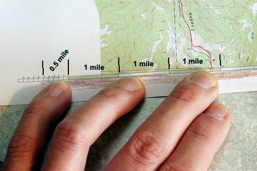
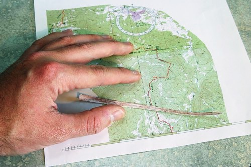
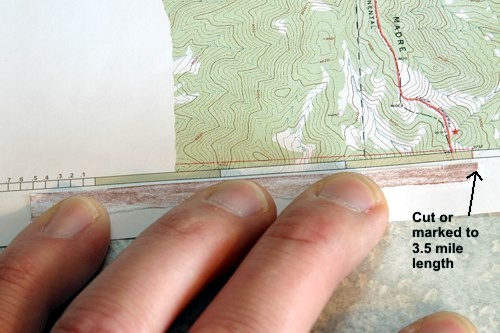
Use a “marker” (a piece of string, or dental floss, an edge of paper, or a straight blade of grass, etc.) to measure out the distance (3.5 miles in this case) indicated by your GPS. Lay it against the scale, and cut or mark the distance.
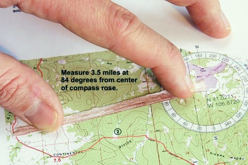
Next, put one end of the marker at the center of the compass rose, and “aim” it at through the bearing indicated by your GPS unit. The other end of the marker will indicate your position.
Limitations
The compass rose coordinates should be fairly accurate, provided I haven’t made any major mistakes. But, you shouldn’t expect more than ~0.1 mile of resolution. That should be enough for any situation along the CDT. Additionally, I use 4 decimal places in the GPS coordinates, this provides accuracy to ~11 meters (assuming I have drawn the center of the compass rose “dead on target”), which should be more than enough detail for navigating the CDT.
If the distance you have to measure is longer than the scale, you’ll just have to improvise!
This method will help you use a GPS to figure out “where you are”. To figure out where to go next, you’ll need to use the map, possibly your compass, and certainly your head.