| August 2004: A climb of Mt.
Adams via the north ridge |
| |
|
|
 |
|
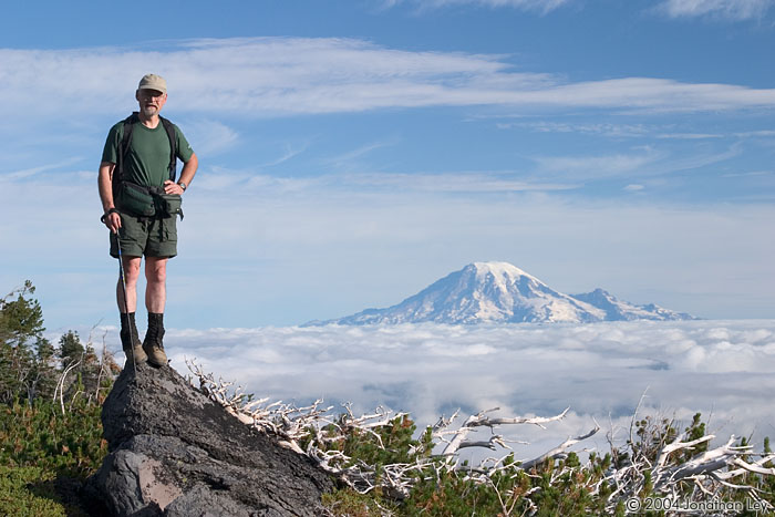
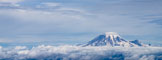
Loren and I had originally planned this climb
of Mt. Adams as a two-day trip, but an approaching storm forced us to squeeze
it into one day. We left the trailhead at 6:25AM under the cover of low morning
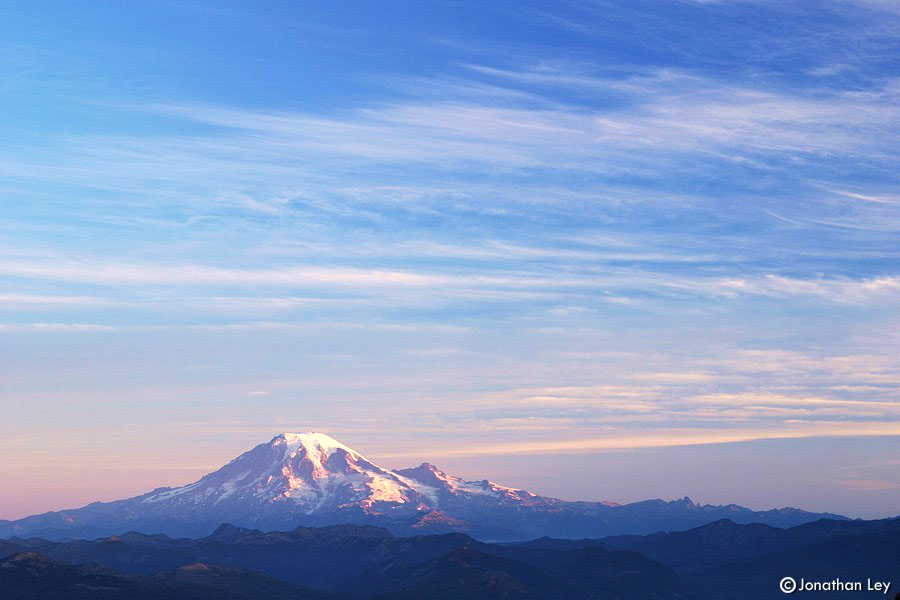
clouds. A couple hours later, we had climbed above the clouds and were treated
to clear views of distant Mt. Rainier. |
| |
|
|
 |
|
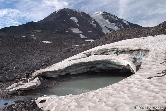
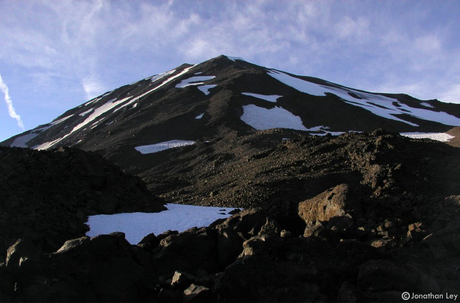
The north ridge of Mt. Adams is the second
most popular route to the top. However, on this day, we met only 3 others along
the way. The route is not technical, but consists mostly of loose volcanic rock
which requires careful footing and extra effort. This can make for slow
progress. |
| |
|
|
 |
|
We spotted this mountain goat near 9,000ft
elevation. We were a bit surprised to encounter a goat at this altitude since
there is virtually no vegetation. However, it appears that some of the rocks in
the area were rich in mineral salts, a favorite treat of the
goats. |
| |
|
|
 |
|
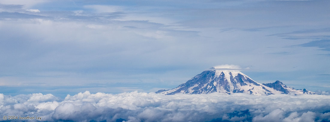
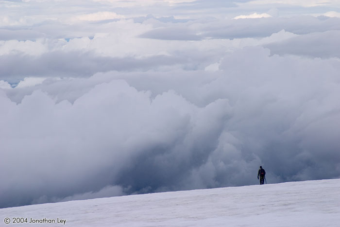
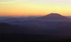
As the day progressed, the low clouds
coalesced, and a small lenticular cloud began to form on the top of Mt.
Rainier. A lenticular cloud is often a harbinger of nasty
weather. |
| |
|
|
 |
|
Until we were nearly at the summit, we
weren't sure if we'd make it before the weather clamped-down. Mt. Adams is
further south and east than many of the other high mountains in the area, which
meant we got a slightly extended "weather window". |
| |
|
|
 |
|
The summit of Mt. Adams is an expansive
glacial-volcanic landscape. |
| |
|
|
 |
|
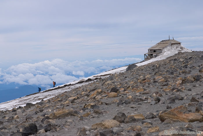
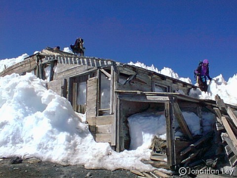
When we reached the old lookout/cabin on top,
we met a few groups of climbers from the south side. |
| |
|
|
 |
|
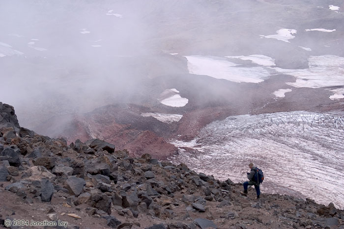
About a half hour after we began our descent,
the summit of Mt. Adams was completely covered in a cloud. The bottom of the
cloud crept down the mountain as we continued, remaining a few hundred feet
above us. |
| |
|
|
 |
|
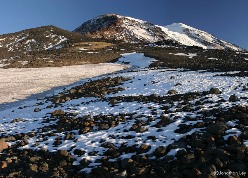
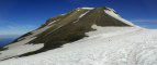
This is a typical view along the north ridge.
The Lava Glacier (just to the east of the north ridge) is far below Loren.
We reached the trailhead at 6:26PM in a light rain - 12 hours and 1 minute
with 7,700ft of elevation gain. Needless to say, I was pretty tired. We cooked
dinner and spent the night at the trailhead. Soon after we had set up a tarp
shelter, the rain grew heavy. The patter of raindrops played the perfect
lullaby for a long and wonderfully rewarding day. |
| September 2003: Adams Creek
Meadows |
| |
|
|
 |
|
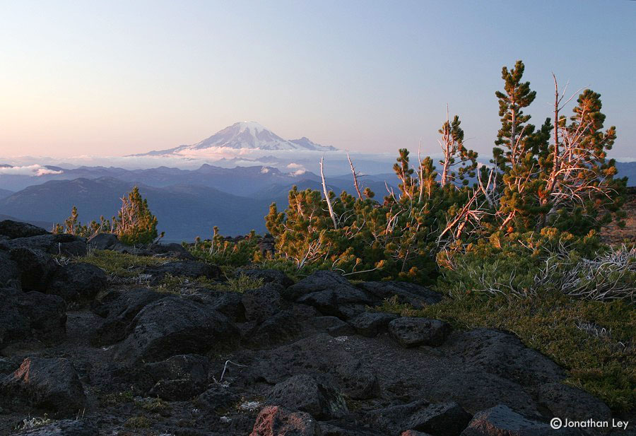
Adams Creek meadows is a high alpine area on
the northwest side of Mt. Adams. A short cross-country hike above the Pacific
Crest Trail leads to the area. From the meadows, there's a great view northwest
to Mt. Rainier (seen here). |
| |
|
|
 |
|
This area is also the start of the second
most popular route to the summit - the north cleaver (ridge). The route is
along the ridge, just to the left of center in this photo. |
| |
|
|
 |
|
The setting sun illuminated some of the
sparse trees growing at over 7000ft elevation. A few grasses grow between the
rocks up to ~8000ft. Above that it's just rock, snow and ice. |
| |
|
|
 |
|
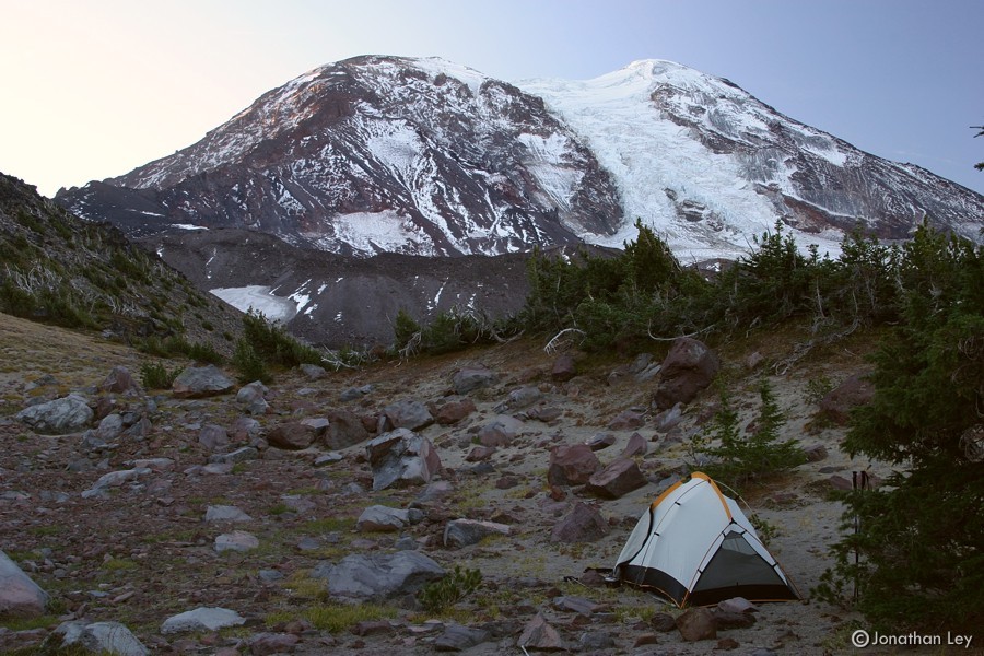
It had snowed 2-4 inches a few days earlier,
but most of that had melted, and we had excellent weather - sunny warm days and
cool dry nights. At night, the sky was filled with clouds of stars. In the
morning, the sun lit up Mt. Rainier, viewed here from our camp. |
| |
|
|
 |
|
We camped at 7000ft elevation. The "soil" was
mostly volcanic ash, deposited by the 1980 eruption of nearby Mt. St.
Helens. |
| |
|
|
 |
|
I'm still not sure exactly what it is about
these landscapes that affects me so deeply, but I'm glad for
it. |
| May 2003: Overnight on "The
Bumper" |
| |
|
|
 |
|
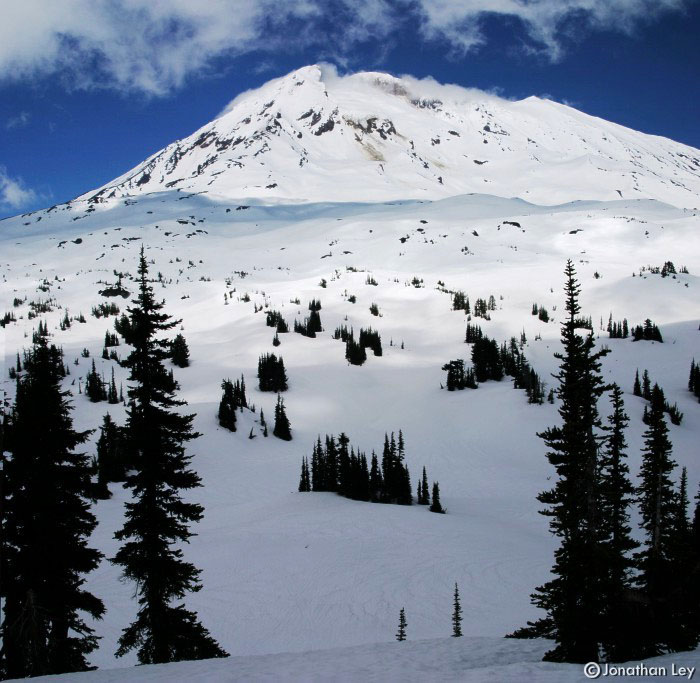
It's never too early in the season (or too
late) to go for a hike along the PCT. The area around Mt. Adams is always
inspiring. I followed the trail for a couple miles until it disappeared under
the solid snowpack. Then, I took out the compass & followed a bearing for a
few more miles to a minor "point" called "The Bumper" - around 6400ft
elevation. |
| |
|
|
 |
|
The skies to the west were obscured with
clouds and haze, but the clouds broke apart as they neared the bulk Mt. Adams.
|
| |
|
|
 |
|
I saw no people, and no other footprints in
the area. Solitude is best experienced alone. |
| |
|
|
 |
|
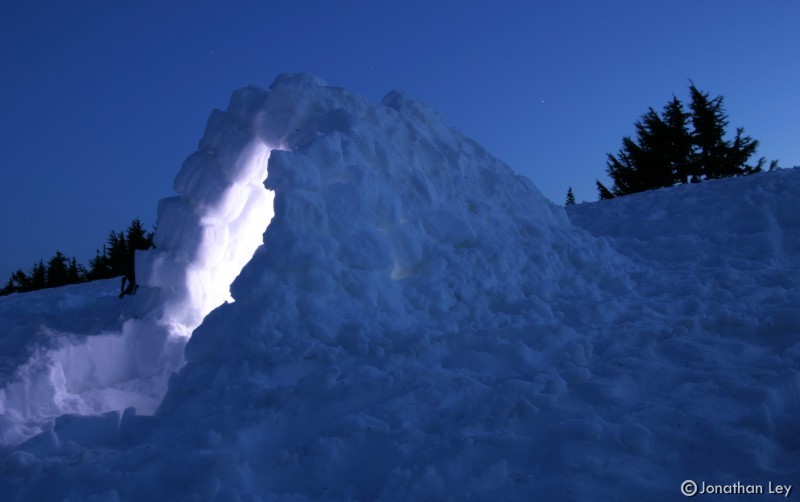
A snow shovel is lighter than a tent, and at
this time of year, the conditions are perfect for building a snow shelter. It
took me about 2hrs to build this one. It was sturdy enough that I could walk on
top of it (the walls were about a foot thick - thicker than they needed to
be). |
| |
|
|
 |
|
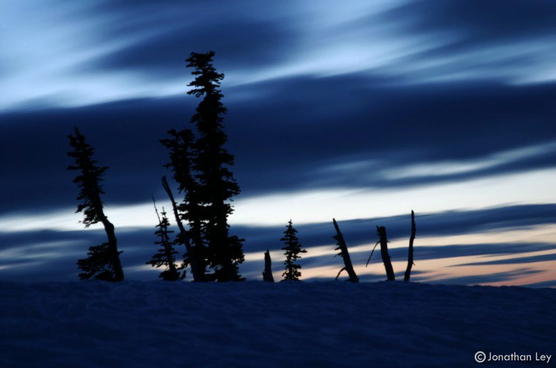
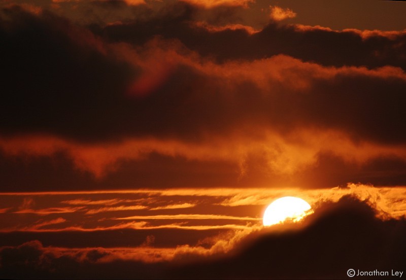
The wind picked up as the sun went down... I
managed to sneak this photo just before the sun disappeared behind the
clouds. |
| |
|
|
 |
|
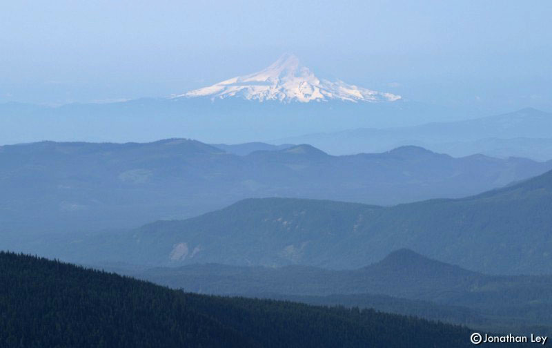
Mt. Hood appears to float above rows of
forested hillsides. The weather was slightly improved in the morning, but I had
to head out. |
| August 2002: Climb of Mt.
Adams |
| |
|
|
 |
|
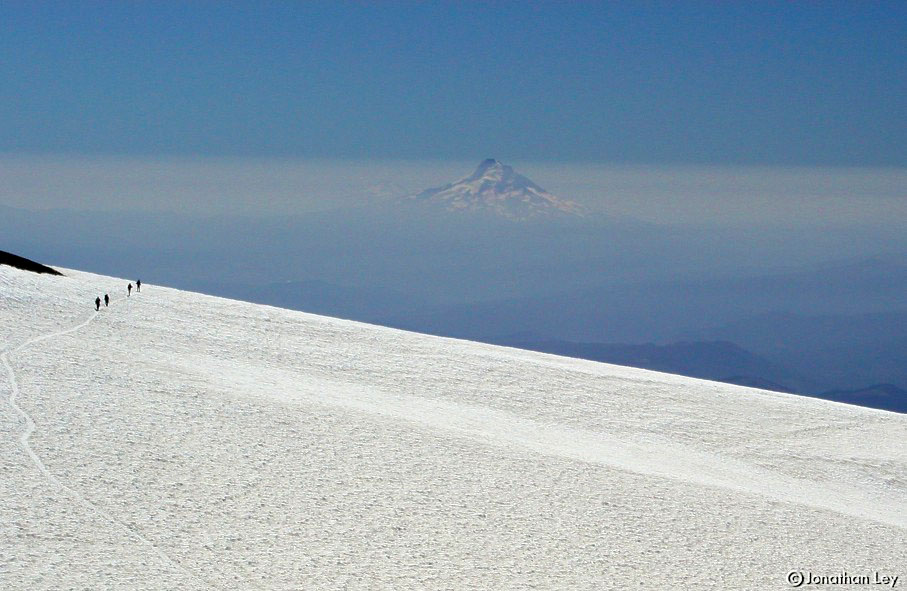
On this trip, we did the "south climb", which
is a mostly non-technical route to the top of this 12,276 ft volcano. This is a
view south to Mt. Hood from about 11,500 ft on the upper slopes of Mt.
Adams. |
| |
|
|
 |
|
We camped on the snow at about 9000 ft
elevation. This is a photo of Mt. Adams from near our camp. |
| |
|
|
 |
|
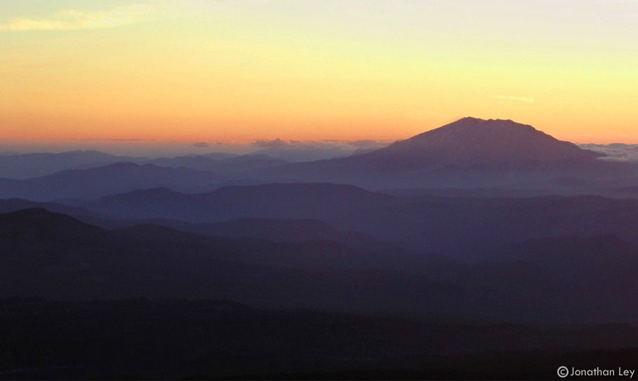
We had great weather during this trip. The
first day, it was clear enough to see all the way south to the 3 sisters -
around 200 miles away! The second day was a bit more hazy, but we still had
great views all around. This is a view of Mt. St. Helens from near our camp
site at 9000ft. |
| |
|
|
 |
|
This is a view of the upper part of Mt. Adams
from the "false summit" at ~11,000 ft. |
| |
|
|
 |
|
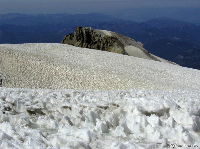
A view north from the summit of Mt. Adams
shows some of the sun-cupped and windswept snowfields on the
top. |
| |
|
|
 |
|
This is a view from the false summit (11,000
ft) back down the south slope. |