| February 2006: A winter trip to the Mt. St. Helens backcountry |
|
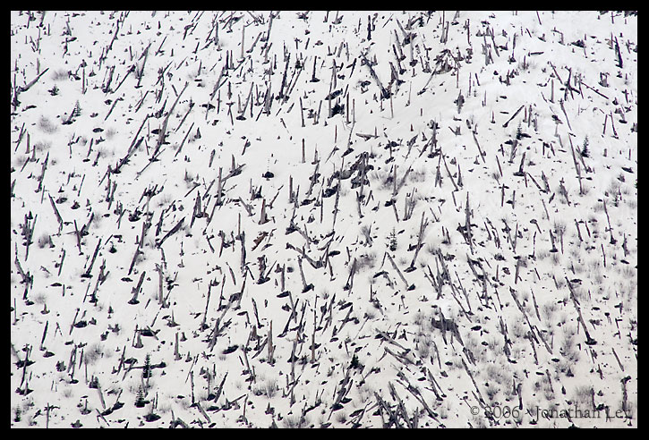
The evidence of the 1980 Mt. St. Helens eruption is still as vivid as ever. Here, a mountainside of trees lays toppled high above Coldwater Creek, 9 miles from the Mt. St. Helens crater.
|
|
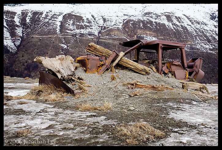
Logging equipment rests half-buried in volcanic debris, undisturbed since that fateful day nearly 26 years ago. The area nearby had been clearcut soon before the eruption. I'm not sure if anyone died at this location during the eruption, but if anyone did witness the eruption from this vantage, it was likely the last thing they saw. The idea that I was possibly walking by someone's grave was not lost.
|
|
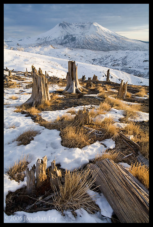
A few brief rays of evening sun illuminate the surroundings in the backcountry north of Mt. St. Helens. The entire area is a research zone, where scientists can measure the rate of recovery from the 1980 blast. Visitors must stay on the marked trails, or where the trails are covered by snow, stay on the snowpack.
|
|
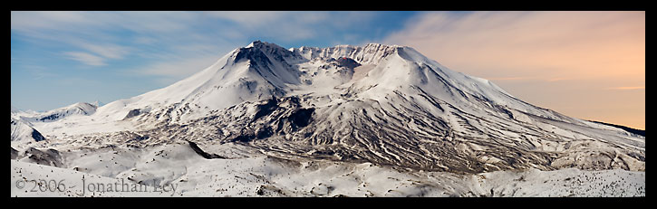
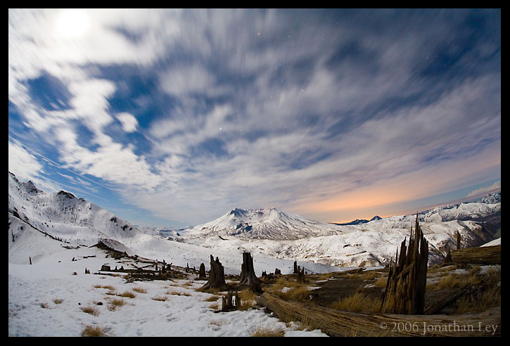
This is a composite panorama view of Mt. St. Helens in the early evening, lit by a full moon. The new lava dome (formed just in the past 1.5 years) is visible as the dark bump high in the crater of the volcano.
|
|
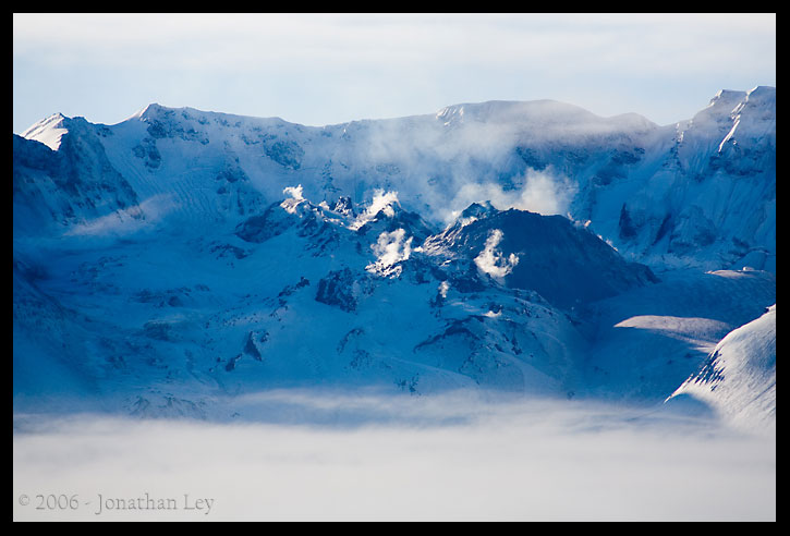
This telephoto view of the crater show more detail of the lava dome. The glowing molten rock isn't visible to the naked eye from this distance. This photo is an exposure taken over a period of about 4 minutes.
|
|
Here a wide "fisheye" view shows the patterns formed by the clouds. The moon is at the upper-left of the frame behind some thin clouds. The orange-colored patch of sky is illuminated mostly by the city lights of the Portland-Vancouver area, and partially by remnants of the setting sun.
|
|
Here, the hot lava dome steams the cool morning air.
|
|
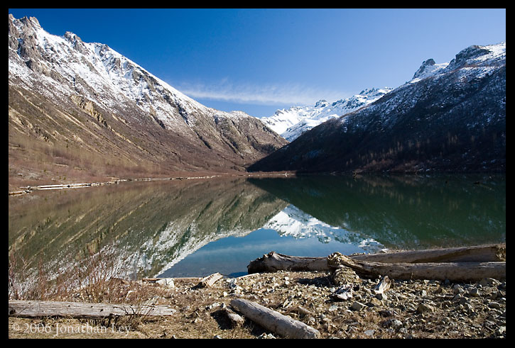
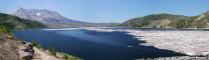
Coldwater Lake was formed when debris from the eruption of Mt. St. Helens dammed Coldwater Creek. A trail leads along the lake shore and into the backcountry area seen beyond the lake here.
|
| April 2004: A climb of Mt. St.
Helens |
| |
|
|
 |
|
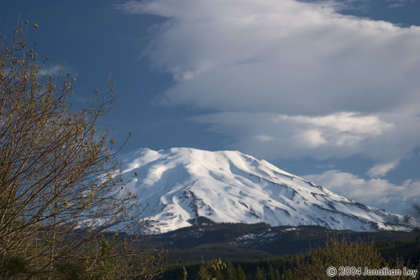
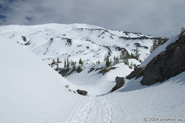
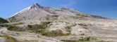
The standard route to the summit of Mt. St.
Helens is up the south side of the mountain, seen here in the early morning. In
summer, the standard route follows Monitor Ridge, but access to that trailhead
can be closed by snowpack. So in the winter months, the route begins a bit
lower on the mountain, and follows a series of ridges further to the east
called the "worm flows". |
| |
|
|
 |
|
The route gains about 6000 ft elevation in 6
miles from the trailhead to the summit. Many people take advantage of the snow
to ski or snowboard back down. I just sat down and glissaded (slid) most of the
way. But, I did have to walk the last couple miles, as the lower slopes just
aren't steep enough to glissade. |
| |
|
|
 |
|
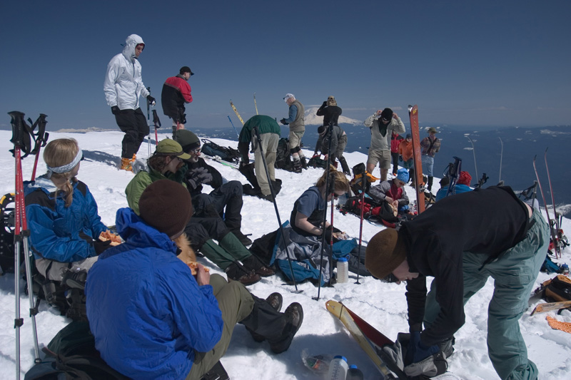
Mt. St. Helens is a popular climb, especially
when the weather is good. From mid-May to mid-November, the number of climbers
is limited to 100 per day. The number isn't regulated in winter, but you do
need to get a permit from a local store from April 1st to May
15th. |
| |
|
|
 |
|
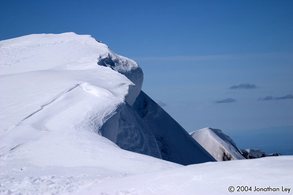
The summit rim of Mt. St. Helens can get
heavily corniced (a cornice is a drift of unstable snow that can form on the
leeward sides of ridges). The north side of the rim is a steep cliff that drops
a thousand feet into the crater formed by the 1980 eruption. Climbers have to
take care stay a safe distance from the edge. |
| |
|
|
 |
|
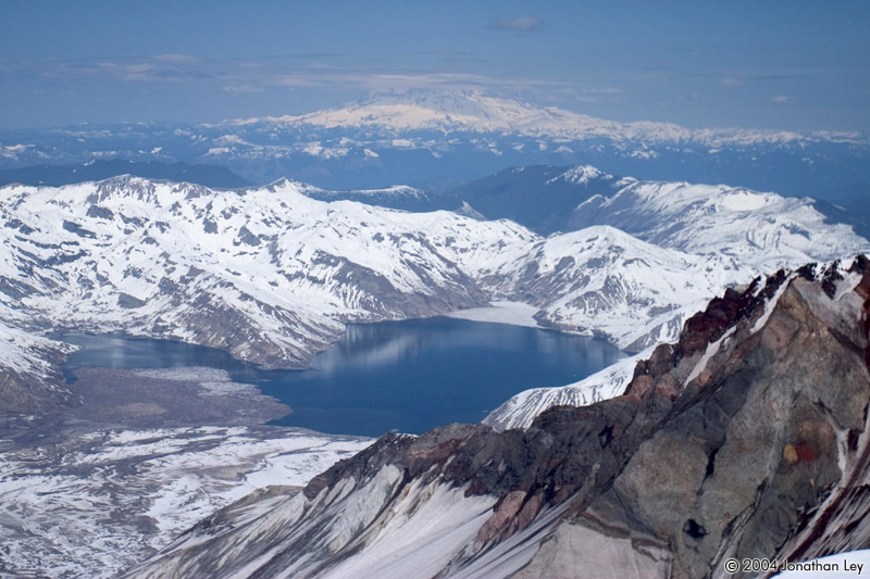
It is possible to peek a couple views to the
north however. Here, Spirit Lake can be seen in the foreground, with Mt.
Rainier in the distance. |
| September 2003: A hike of the
Loowit Trail, around Mt. St. Helens |
| |
|
|
 |
|
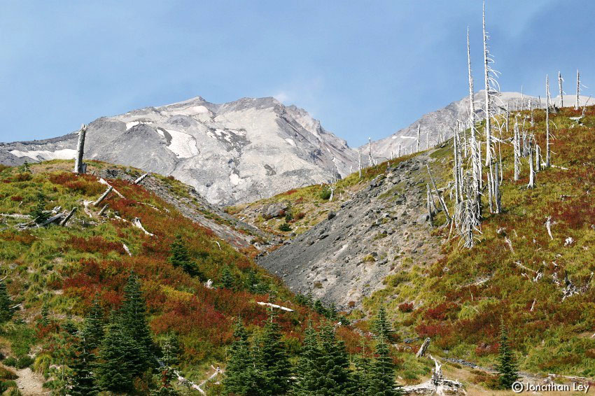
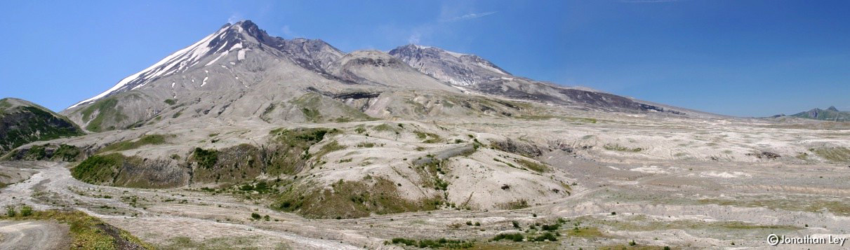
The Loowit Trail encircles Mt. St. Helens,
traversing a diverse landscape of forest, lava, and huge plains of pumice. This
is a view of the north face of the mountain, from the middle of the area that
was devastated during the 1980 eruption. |
| |
|
|
 |
|
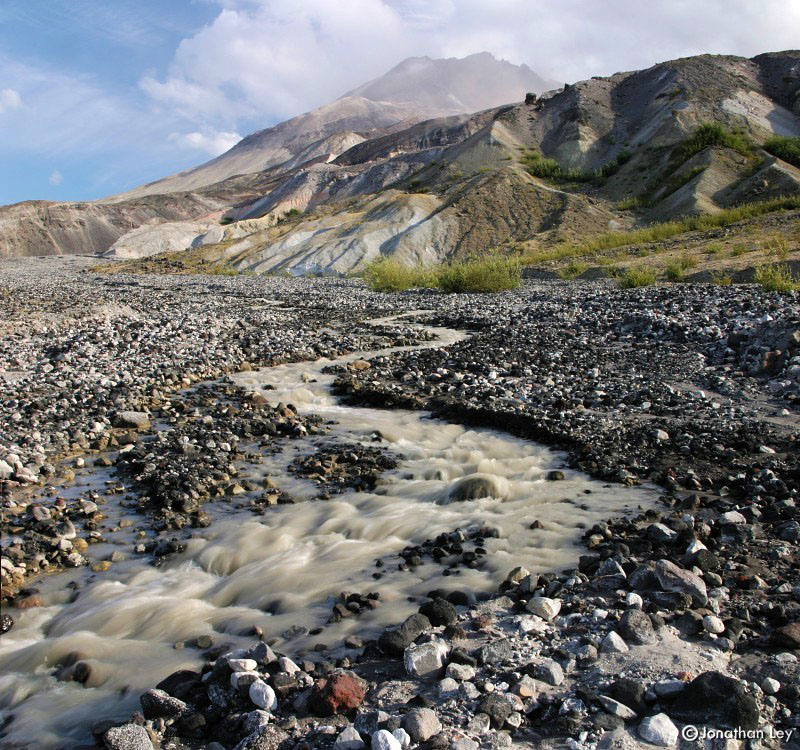
This is a view of another stream flowing from
inside the crater north toward the Toutle River. The geography of this entire
area was completely re-shaped by the 1980 eruption. Much of the steep hillsides
are very unstable, it's common to hear and see large boulders tumbling down the
slopes. |
| |
|
|
 |
|
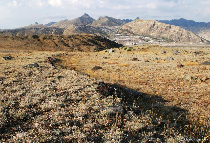
Looking north from the blast zone shows the
gigantic scope of eruption. Virtually everything in view was obliterated in
1980, and much of it will take decades to recover. |
| |
|
|
 |
|
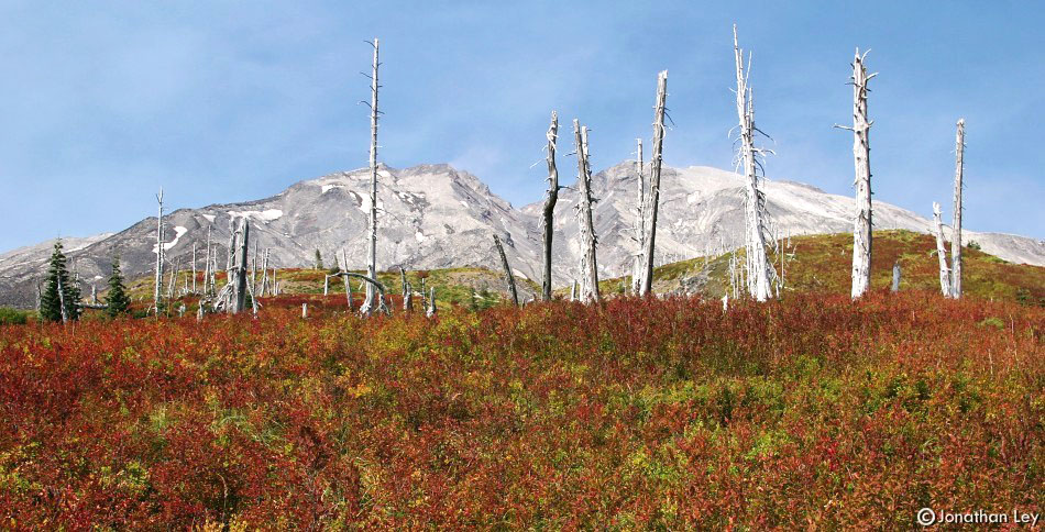
Along the east side of the mountain, the
destruction is not quite as complete. Standing dead trees are a monument to the
1980 blast. |
| |
|
|
 |
|
The trail mostly stays in the range of 4000ft
to 5000ft. I started at June Lake on the south side of the mountain and
traveled counter-clockwise. I camped along the South Fork Toutle river on the
mountain's west side, then finished the trail the next morning. The trail is 28
miles long, plus it's at least a 1.5 mile hike to get to the Loowit Trail from
the nearest trailhead. That makes the trip 31 miles... The tread is often over
broken lava fields and across slopes of loose ash, making it feel a bit
longer. |
| |
|
|
 |
|
The Loowit Trail was a rewarding experience -
sometimes easy, sometimes challenging, and always interesting. I look forward
to returning in different seasons to see more faces of this complex mountain
landscape. |
| July 2003: A visit to the
Windy Ridge area, northeast of Mt. St. Helens |
| |
|
|
 |
|
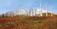
The Windy Ridge Lookout is at the end of the
road that heads to the mountain from the northeast side. A trail leads a couple
miles from the end of the road to this spot, and connects to the trail system
around the mountain.
Yes, the wisps of clouds near the top of the mountain
are caused by the heat of the volcano. |
| |
|
|
 |
|
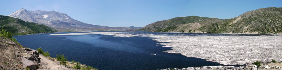
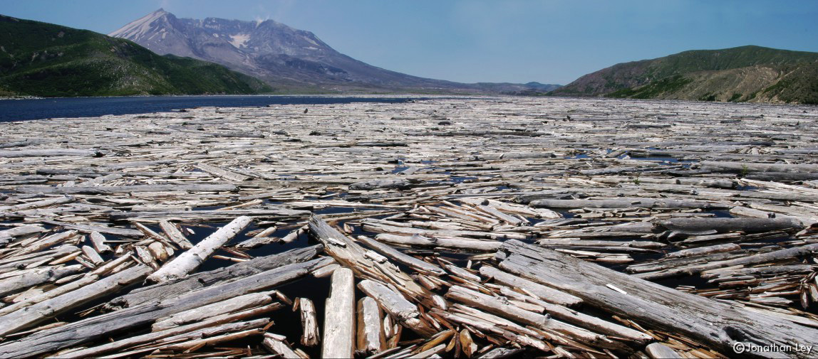
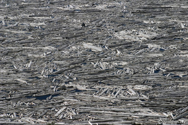
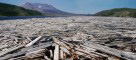
When Mt. St. Helens most recently erupted in
1980, Spirit Lake was inundated with fallen trees and volcanic debris. The
fallen forest still floats on the surface of the lake. |
| |
|
|
 |
|
There's only one trail that leads to the
lake's shore. It's about a 1 mile walk from the road along Windy
Ridge. |
| |
|
|
 |
|
It was fascinating to see the wind blow the
logs across the lake. While we were there, the logs moved across half the
surface of the lake. The pattern is ever-shifting and
re-forming. |
| |
|
|
 |
|
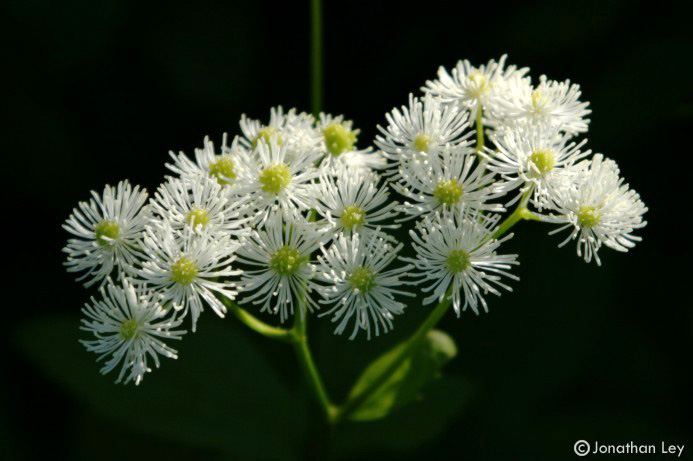
Flowers (these are False Bugbane) were just
coming into bloom along the trail to Mt. Margaret, due north of the Mountain.
Mt. Margaret was directly in the path of the 1980 blast. |
| |
|
|
 |
|
The land is slowly healing its scars, but it
will take dozens of additional years to completely recover to the pre-1980
state. |