![]()
CDT on Google Earth
Intro
Google Earth is free software that allows you to view a super high-resolution photo of the entire earth (actually a composite of many photos stiched-together). This giant earth-photo is overlayed onto a 3D representation of the topography underneath. You can change your angle of view, elevation of view, and generally "fly around" and get a pretty good idea of what things look like - just about anywhere.
Because of the massive amount of data that needs to be downloaded for it to work, Google Earth is really only practical if you have a high-speed internet connection, and it sure helps if you have a fast computer & big monitor too.
Get Google Earth
The Google Earth software is available for free download from: http://earth.google.com
The CDT...
Google Earth also allows you to add layers onto the view. You can view things like roads, borders, notes left by other users, buildings, and more. With the latest release - Google Earth 4, adding your own layer content is easier than ever before. These layers are saved in a ".kmz" (or .kml) file. I've created a .kmz file that displays the entire CDT. The file is named "cdt.kmz" - click here to download it. The file is about 160Kb.
To see the CDT displayed on Google Earth, install & launch Google Earth, then download the file cdt.kmz, and save it somewhere on your computer. Then, go to the Google Earth software and select File->Open... and open the file "cdt.kmz". (or, you can open it directly in Google Earth)
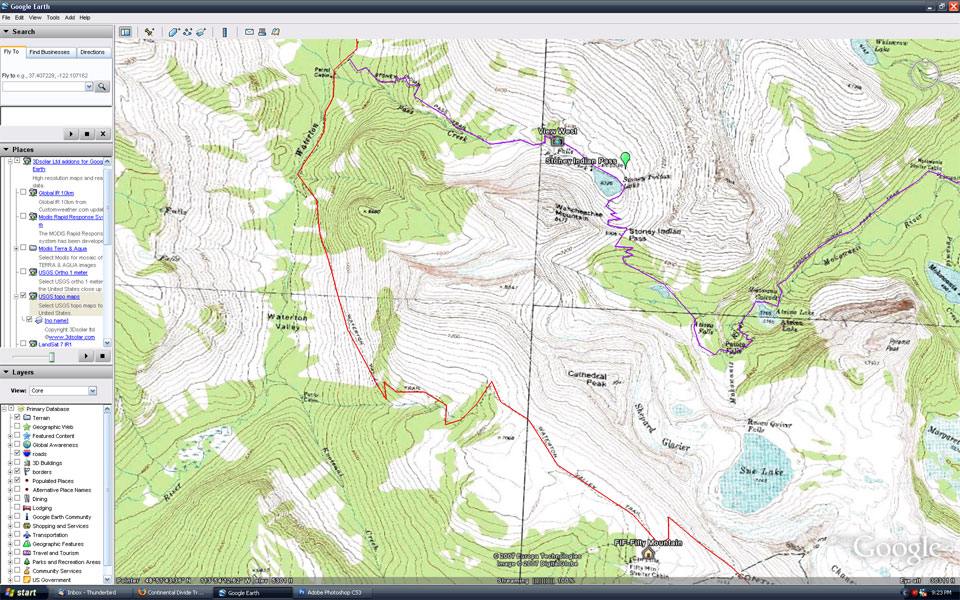
Topo Maps
While Google itself hasn't yet added USGS topographic maps to the Google Earth layer set, various 3rd parties have stepped-in. One of these, www.3dsolar.com, has created a pretty good solution. I've included this in the cdt.kmz file I've created. Just check the topo map box (it should be pretty obvious when you look at the file). Topo maps will snap into view in an appropriate size as you scroll around. These tend to look best if you're looking down from an altitude of around 23,000 feet or so.
If you want to see more, you can download the 3dsolar.com add-on here (which also includes more map overlays):
http://www.gelib.fox-fam.com/3dsolar-addons.htm (Click the "G-Earth" icon)
Grand Plans
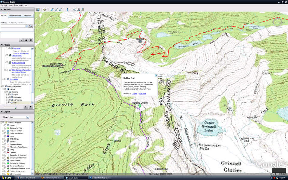
I first drew the base route of the CDT in early 2006. At that time, there wasn't a very good GUI .kml editing tool. But Google Earth has improved since then (July 2007), making it more practical to edit and add-to the route. Zoom-into the very north part of the trail in Glacier National Park, and you'll see what I mean. I've refined the main route, added some alternate routes, a few notes and comments, and links to some photos of nice views.
In theory, anyone could download the file I've created, and add to it, or create their own version. You could also add shaded boxes for things like "burned areas", "property boundries", etc. As of now, there is no central repository of a "Grand master CDT .kmz", except the one I've created I suppose. If you make a cool addition to the file, I'd be willing to post a copy here - just e-mail it to me: jonathan@phlumf.com.
I'm not sure this will become a practical mapping resource for actual CDT hikers, as printing these maps wouldn't be very practial... but who knows what the future might bring.
What it looks like
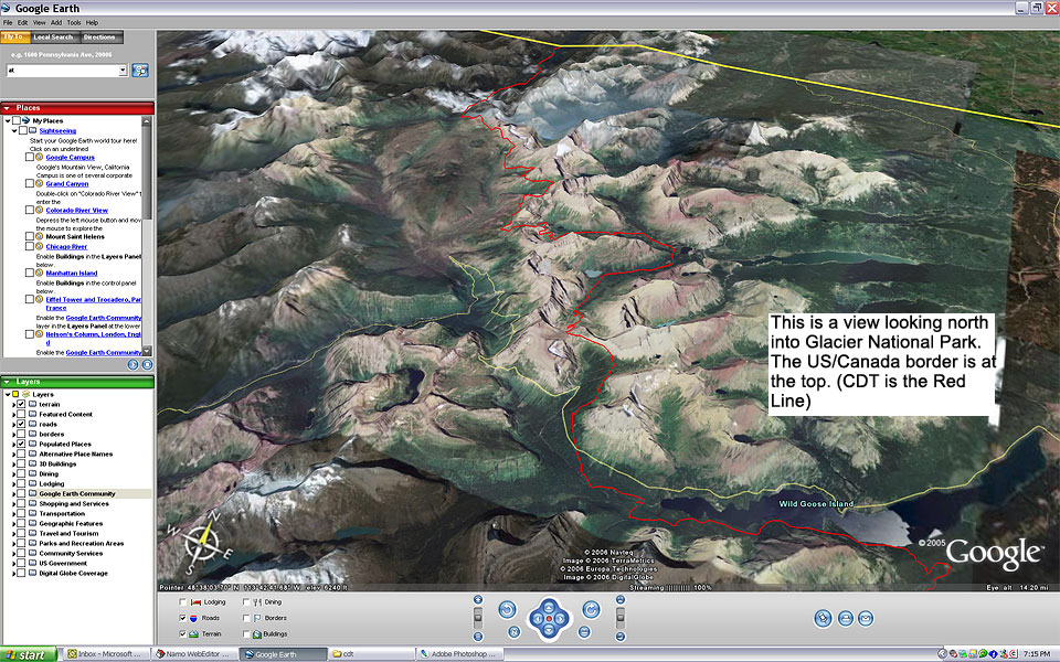
If you're curious to see what this all looks like, even if you haven't downloaded or used Google Earth, check out these screen-shots. Note: these are resized to "50%" to make the file sizes a bit smaller & more "universally viewable". These are all views in Glacier National Park, some with the topo map overlay, and some without it. But, these stills don't compare to the real thing of course... you can't see smooth animation/flyby view that makes Google Earth so compelling.

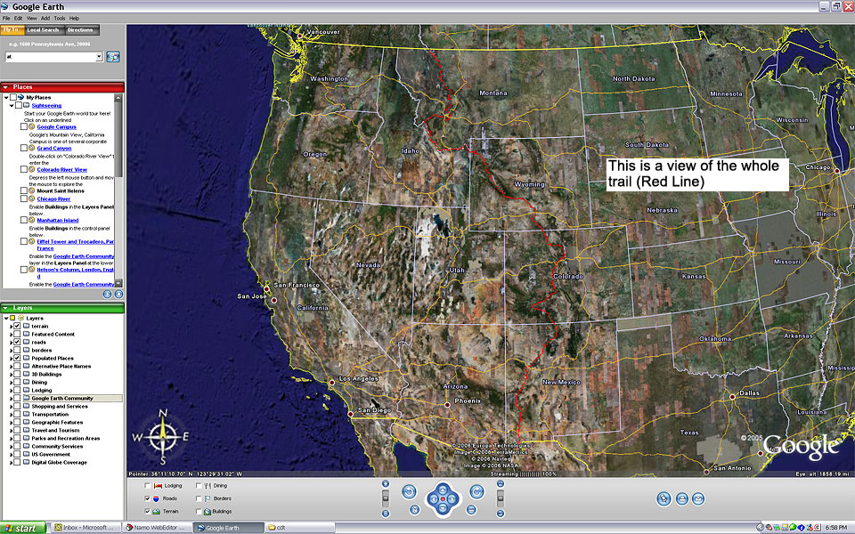
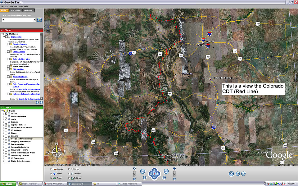
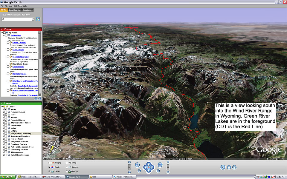
These are some other snapshots of what the CDT looks like on Google Earth - I did these in 2006, before the latest update: